Public filings describe a data center and related applications for solar generation, natural-gas generation, energy storage, and produced-water recycling.
UpdatedMay 27, 2026
Data center
Nine Mile Data, LLC
Known from filings: The data-center CUP findings header lists four parcels totaling about 960.32 acres. The application narrative separately describes about 475 acres for data-center use within a larger leased area of roughly 879 acres across three contiguous parcels. These figures come from different parts of the filings, which do not state how the two parcel descriptions relate.
Scale described: About $10 billion investment, up to 1,000 construction workers, about 200 long-term jobs, and about $74.7 million in annual property tax revenue.
Known from filings: reWater LLC materials describe additional recycling ponds and about 1,787,632 barrels of storage capacity at the Pleasant Valley E&P Waste Disposal Facility.
Project narrative: Culinary water would be limited, while process/cooling water would largely come from Wasatch Energy Management through a shared process-water system.
Public information need: Construction routes, road timing, workforce housing, emergency response, noise, and light should be published as project details become available.
Site function: The final site should maintain updates, notices, and contact information for residents.
From the public record
Engineering drawings from the county findings reports.
These exhibits are drawn from the conditional-use-permit findings reports filed with Duchesne County on April 2, 2026 and prepared by Jones & DeMille Engineering. They are preliminary submittal drawings — several are marked “Review / Not for Construction” — not final, as-built construction documents. Each sheet is captioned with its source report and page.
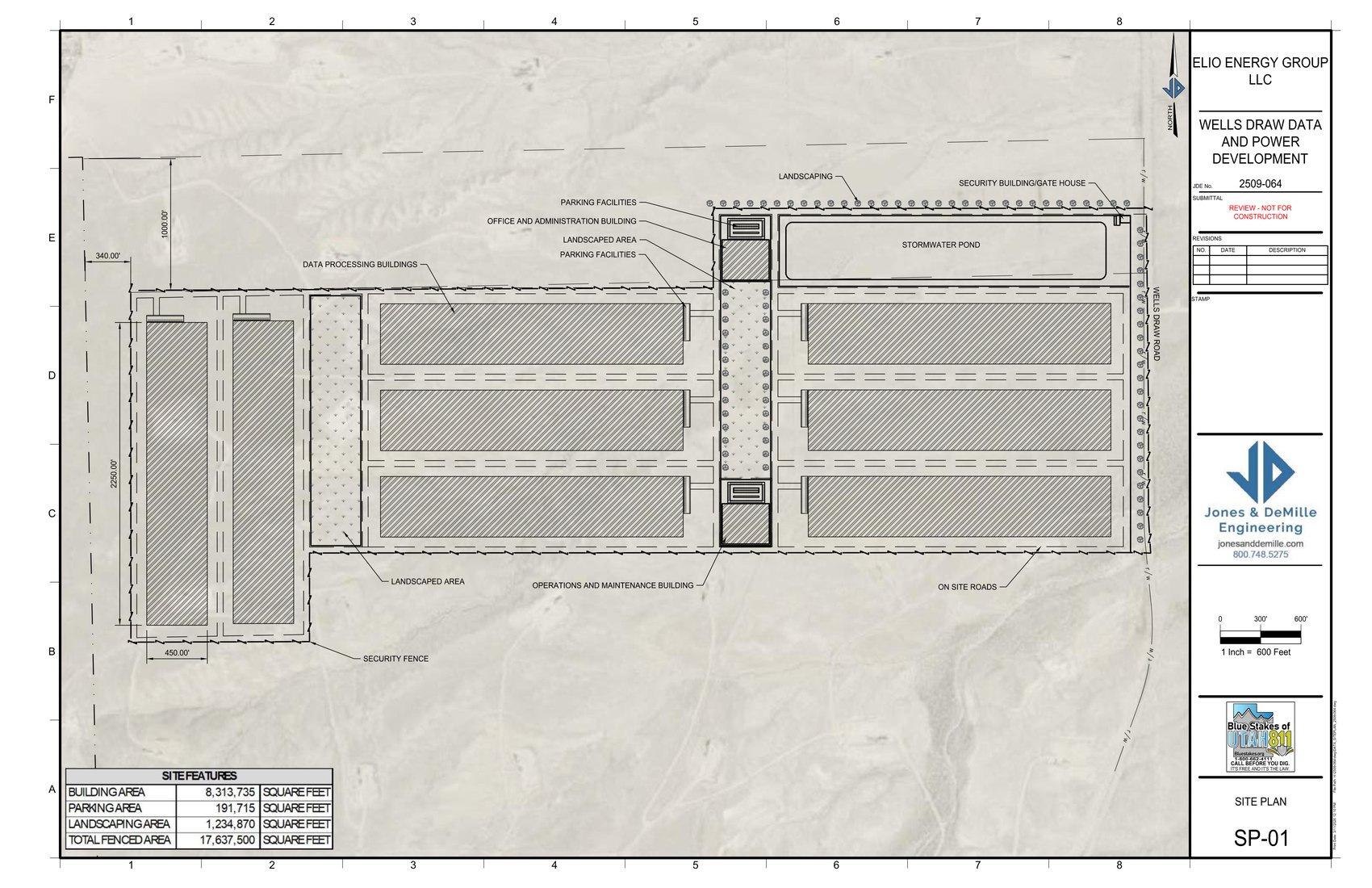
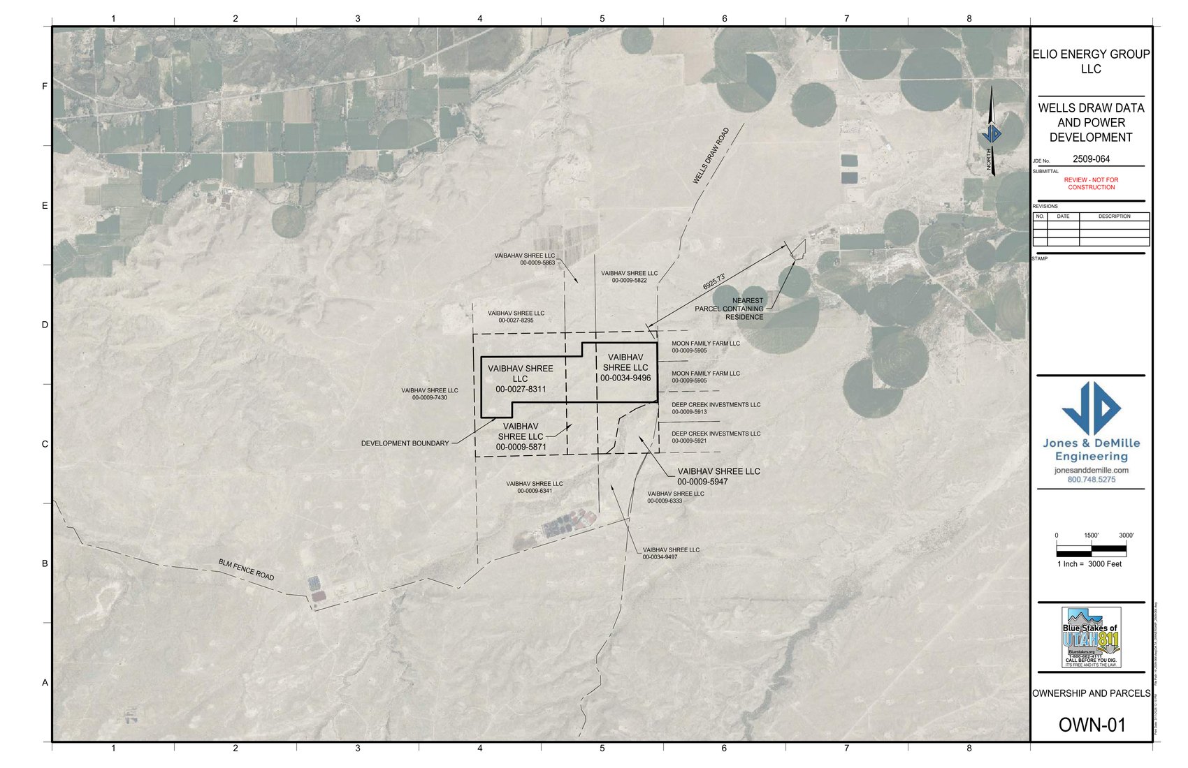
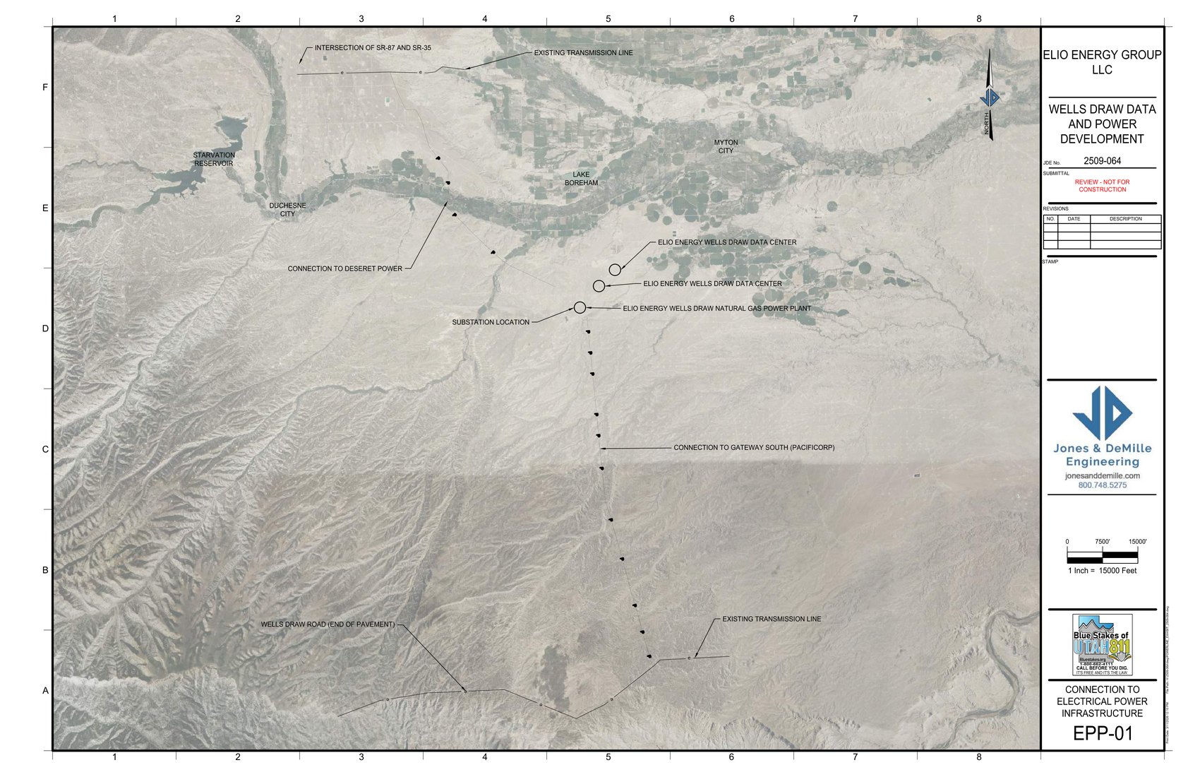
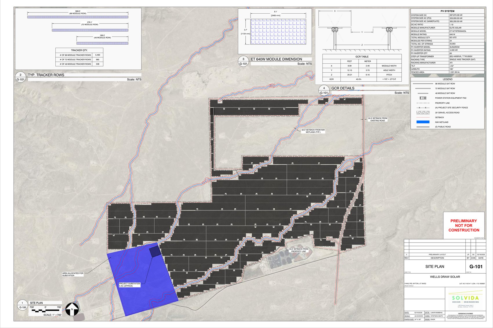
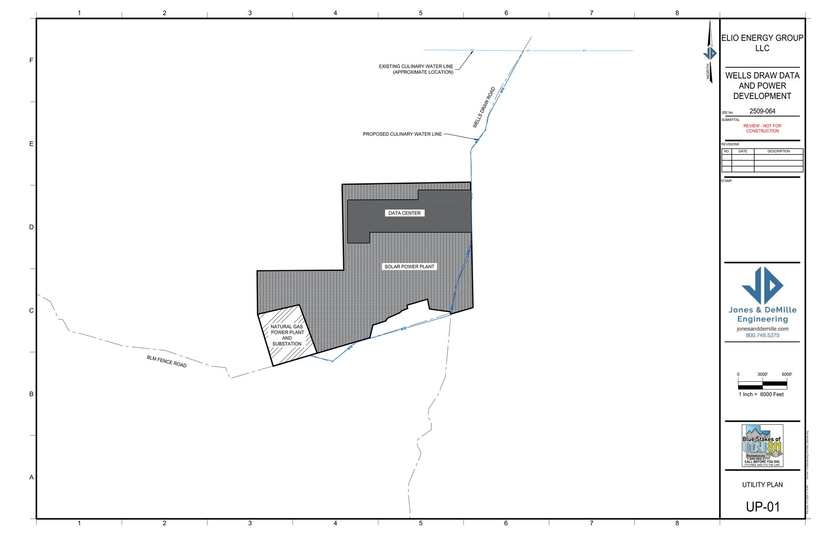
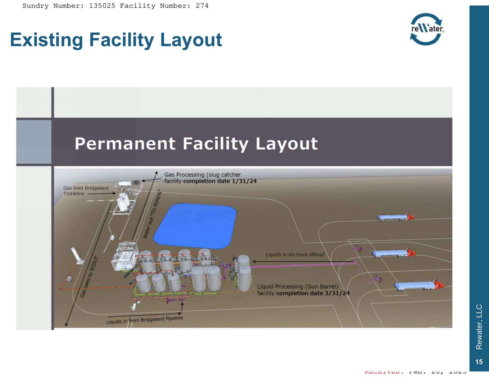
Data center site plan (SP-01). Data-processing buildings, parking, landscaped areas, security buildings, a stormwater pond, an operations and maintenance building, and on-site roads for the Wells Draw Data and Power Development.Nine Mile Data, LLC findings report, p. 16 — Duchesne County, Apr. 2, 2026Ownership and parcels (OWN-01). The Vaibhav Shree LLC parcels and the development boundary along Wells Draw Road, with parcel identification numbers.Nine Mile Data, LLC findings report, p. 14 — Duchesne County, Apr. 2, 2026Electrical interconnection (EPP-01). Proposed connections to Deseret Power and to Gateway South (PacifiCorp), the substation location, and existing transmission lines.Nine Mile Data, LLC findings report, p. 21 — Duchesne County, Apr. 2, 2026Solar site plan (G-101). Photovoltaic tracker-row layout and array boundary for the Wells Draw Energy solar power plant. Marked “Preliminary — Not for Construction.”Wells Draw Energy solar findings report, p. 22 — Duchesne County, Apr. 2, 2026Utility plan (UP-01). Data center, solar power plant, and natural-gas power plant / substation footprints, with existing and proposed culinary water lines.Nine Mile Data, LLC findings report, p. 18 — Duchesne County, Apr. 2, 2026reWater facility layout. Permanent layout for the reWater produced-water disposal facility — gas processing (slug catcher), liquids processing (gun barrel), storage tanks, truck offload, and Bridgeland pipeline connections.reWater, LLC produced-water findings report, p. 23 — Duchesne County, Apr. 2, 2026